- Local News
- Sun-2020-06-14 | 03:19 pm

Historically, the profession of surveying followed the development of large structures, and historical evidence indicates that surveyors were hired by Egyptian pharaohs when temples, pyramids and public buildings were constructed, said surveyor Qutaiba Dasouki.
"The rope and stretcher, with a use of simple knowledge in geometry, was enough to establish boundaries after the Nile River floods,” Dasouki noted.
Romans also recognised land surveying as a separate profession and basic measurements were established to divide the Roman Empire’s provinces, he noted, adding that in the Roman state, surveyors were called "gramatici”.
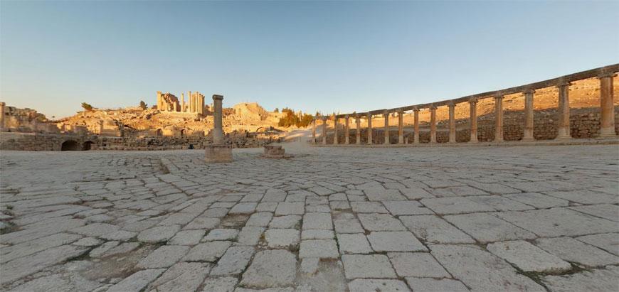
Today, Dasouki employs Panorama 360 imagery — a photograph spanning a full circle in side view — showing an archaeological site to both experts and the general public.
"Panorama 360 is a very useful tool for museums, visitor centres and websites,” he said, noting that with high resolution, the user can zoom in and zoom out, having a perfect angle of a building from the outside and inside.
"The programme can be used for the documentation of a site during restoration, and it saves time,” Dasouki said, adding that he began utilising the programme in 2013 while working at the Ummayad Palace on Amman Citadel.
The surveyor worked with Panorama 360 in Petra, Jerash and the Roman Theatre in Amman.
"A quality shot depends on the weather conditions,” Dasouki said, adding that he talked to the management of the Petra Archaeological Park and requested them to give him more ideas on how to show the best sites, including less known monuments and tombs.
"The morning is good for a shot, but midday is the best because there’s no shade. Clear sky creates the best conditions for a shooting session with Panorama,” Dasouki said.


